Documentation

How FloodTwin works

Six short workflows, from checking your credits to comparing a measure against the baseline. FloodTwin combines 1 m LiDAR terrain, the Deltares SFINCS 2D solver, measure comparisons and freeboard checks in Ostend height (m TAW).

Buildings evaluated
2,428
≥ 15 cm in the baseline
646
Solver time
8.3 s
CSI vs VMM zones
0.36

Deurne pilot, 59 mm / 3 h design cloudburst, SFINCS v2.5.0, measured 17 November 2026.

01Membership of a FloodTwin organisation.

Check readiness and credits

Confirm your simulation credits, the readiness tier of the catchment and the latest baseline before you spend compute.
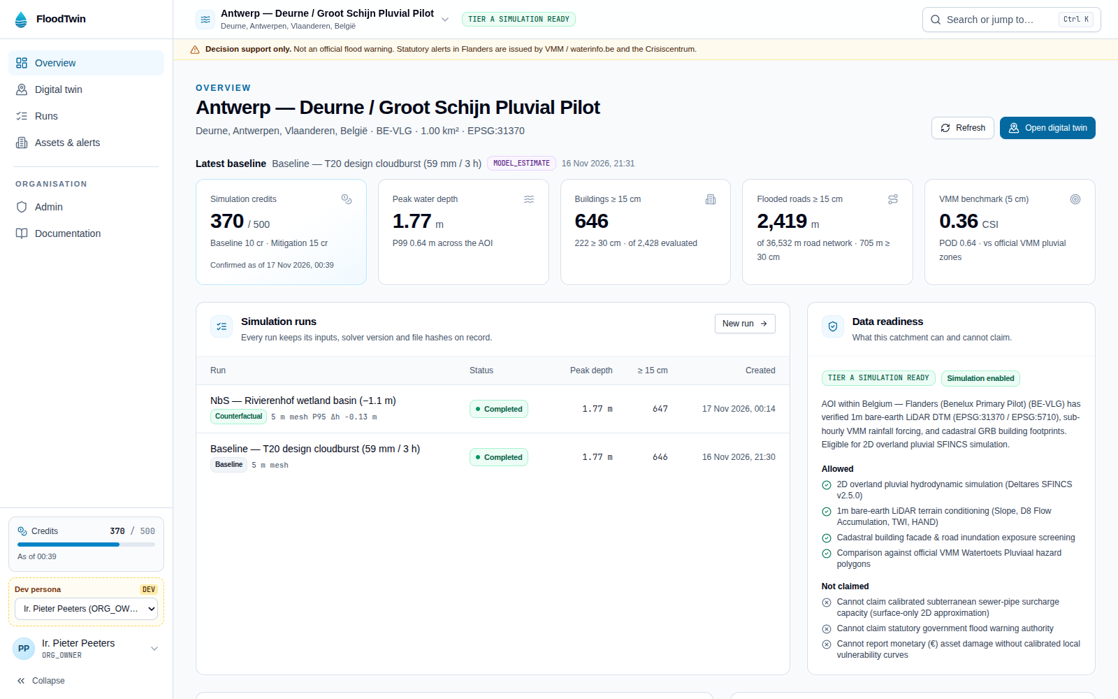
FloodTwin overview dashboard with the credit balance, readiness tier and critical asset freeboard table.
Overview (/dashboard): credit balance with its confirmation time, latest baseline figures and readiness.
  1. 1Open Overview from the left sidebar.
  2. 2Read the Simulation credits card: balance, the cost of a baseline and of a mitigation run, and the time the balance was confirmed.
  3. 3Check the Latest baseline cards (peak depth, buildings and roads above 15 cm, VMM benchmark) and the Data readiness panel.
  4. 4Choose Open digital twin to move into the map workspace.
02Role ORG_OWNER or HYDROLOGIST on a Tier A catchment.

Explore the 3D twin and run a storm

Inspect extruded LiDAR buildings over the 1 m bare-earth terrain (2,428 buildings on the Deurne pilot) and solve a 2D cloudburst with Deltares SFINCS.

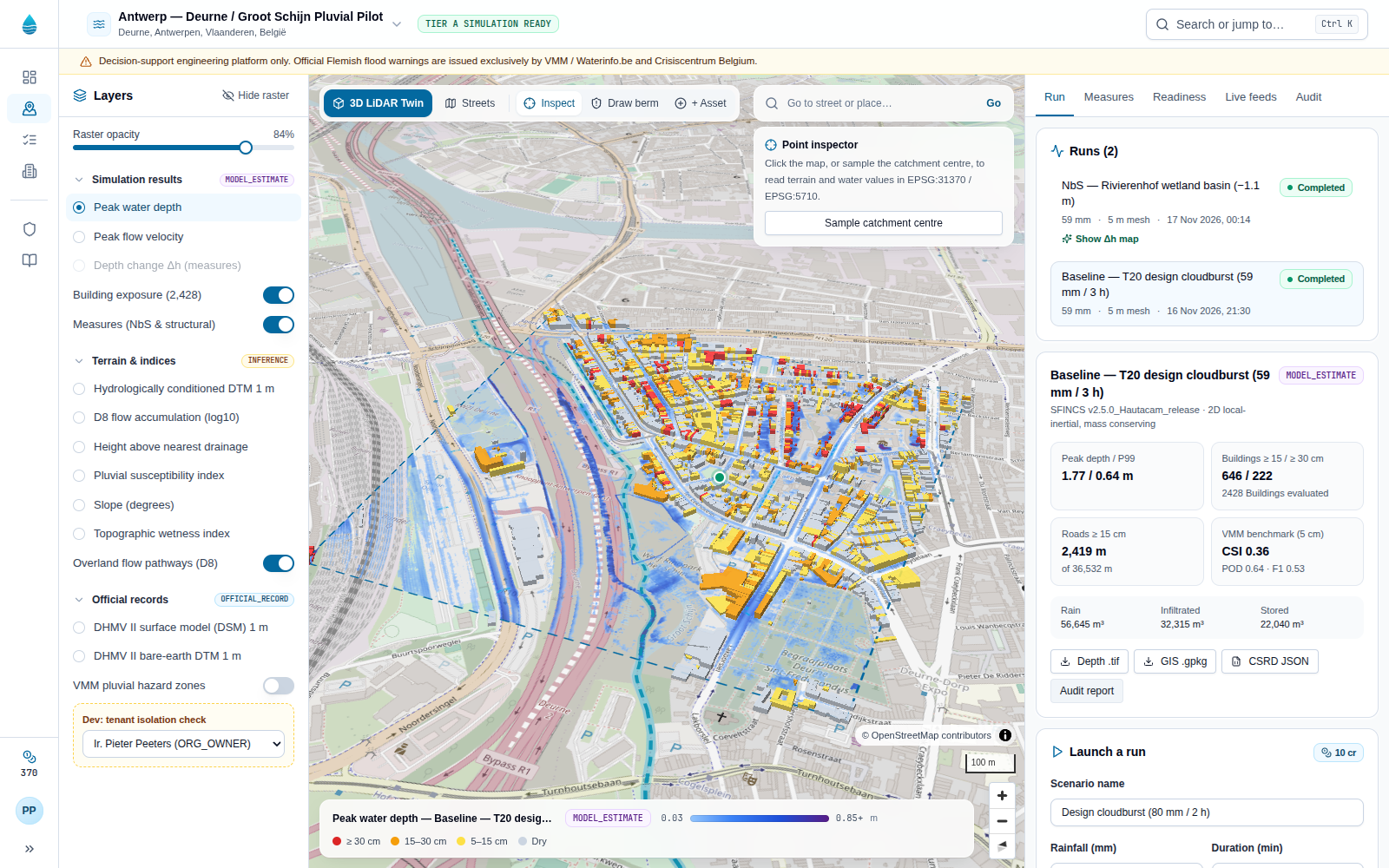
FloodTwin digital twin workspace with extruded buildings coloured by simulated flood depth and the run panel.
Digital twin (/workspace): 1 m depth tiles, building exposure and the run parameters.
  1. 1In Digital twin, keep 3D LiDAR Twin switched on in the map toolbar and pick a layer in the Layers panel on the left.
  2. 2Click the map, or choose Sample catchment centre in the Point inspector, to read terrain and water values in m TAW.
  3. 3In the Run tab on the right, enter a scenario name, rainfall, duration, climate uplift, infiltration and solver mesh.
  4. 4Choose Run 2D SFINCS solver. Credits are reserved, the solver runs out of process and the depth and velocity rasters appear when it finishes.
03A completed baseline run on the catchment and enough credits for a mitigation run.

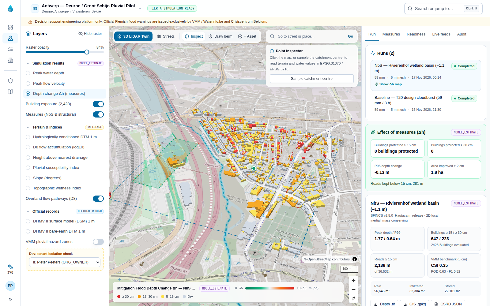
Compare a measure against the baseline (Δh)

See where a retention basin, berm or sponge street lowers the water, and where it does not.

Depth change (Δh) map of a mitigation run, with green areas where the water level drops.
Depth change map: Δh = depth with measure − depth in the baseline, at 1 m.
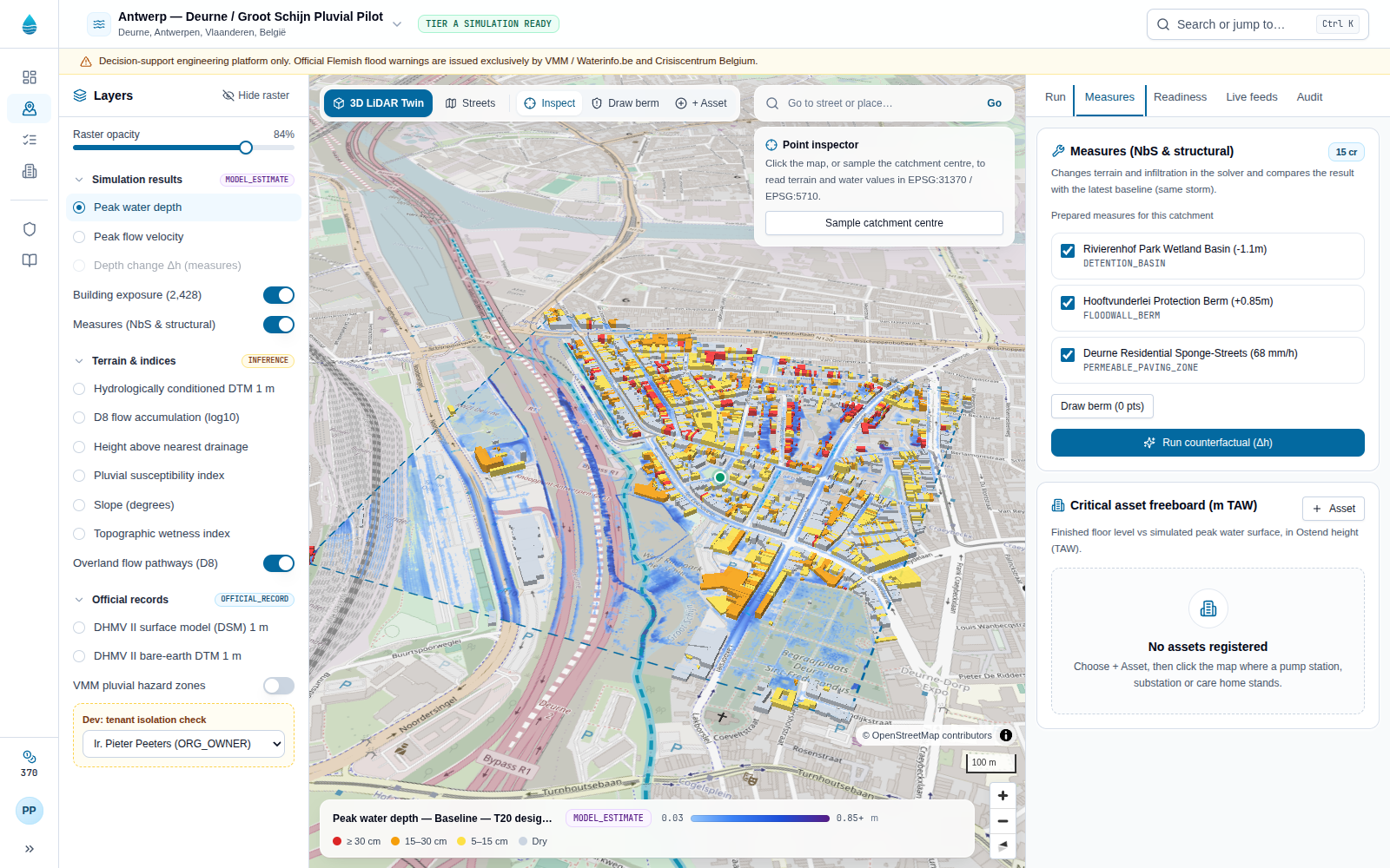
  1. 1Open the Measures tab and tick the prepared measures for this catchment, or choose Draw berm and click its crest line on the map.
  2. 2Choose Run counterfactual (Δh). It reuses the storm, losses and mesh of the latest baseline so only the measure differs.
  3. 3When it completes, choose Show Δh map on the run in the Run tab.
  4. 4Read the Effect of measures card: buildings and roads kept below 15 and 30 cm, P95 depth change and the area improved.
04Role ORG_OWNER, HYDROLOGIST or OPERATIONS_REVIEWER.

Track critical asset freeboard (m TAW)

Compare the finished floor level of pump stations, substations, care homes and underpasses with the simulated water surface.

Critical asset freeboard panel listing assets with floor level, peak water level and status badges.
Critical asset freeboard: floor level against peak water surface in Ostend height (EPSG:5710).
  1. 1Open the Measures tab and find Critical asset freeboard, or use Register an asset from the overview.
  2. 2Choose + Asset (in the panel or the map toolbar) and click where the asset stands.
  3. 3FloodTwin samples the bare-earth ground level; enter the name, category and plinth height and save.
  4. 4Switch between runs in the Run tab to see how each scenario changes the freeboard.
05Role ORG_OWNER or OPERATIONS_REVIEWER to approve alerts.

Review forecasts and alerts

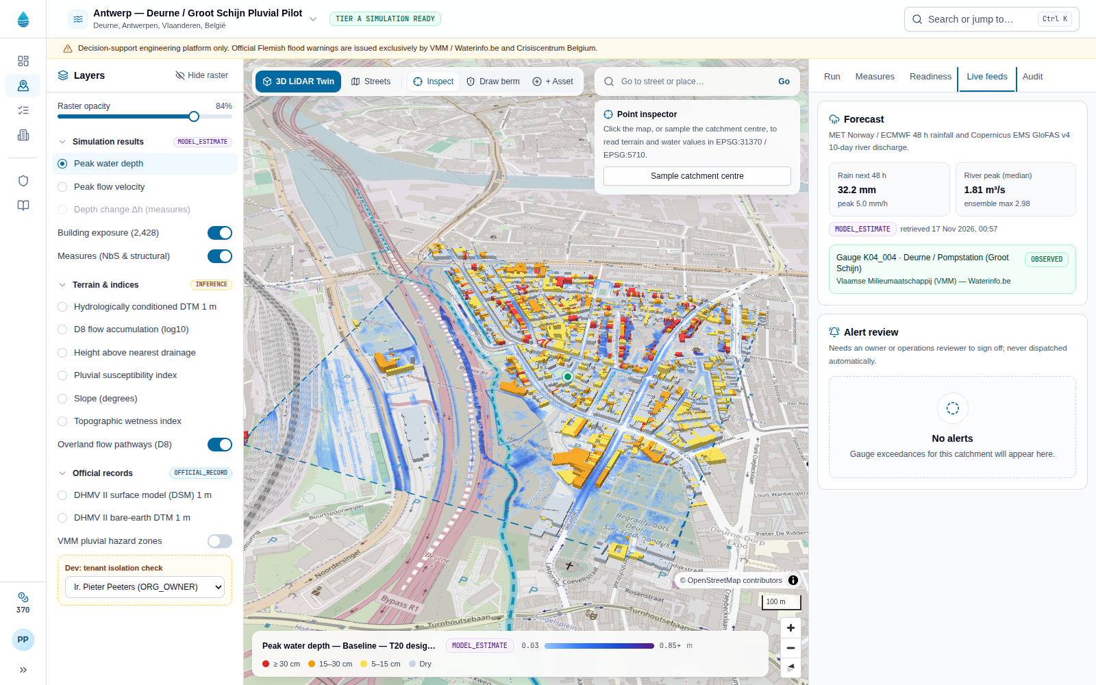
Combine the 48 h MET Norway / ECMWF rain forecast, the 10-day GloFAS v4 discharge forecast and observed VMM gauges, with a human sign-off on every alert.

Live feeds tab with rainfall and river discharge forecasts, the gauge status and an alert awaiting review.
Live feeds: forecasts, the observed gauge and the human-in-the-loop alert queue.
  1. 1Open the Live feeds tab in the digital twin.
  2. 2Read the rain total and peak for the next 48 hours, the river discharge peak and the observed gauge.
  3. 3Under Alert review, read the exceedance and choose Approve or Dismiss.
  4. 4Open the Audit tab to see the decision appended to the hash chain.
06Role ORG_OWNER.

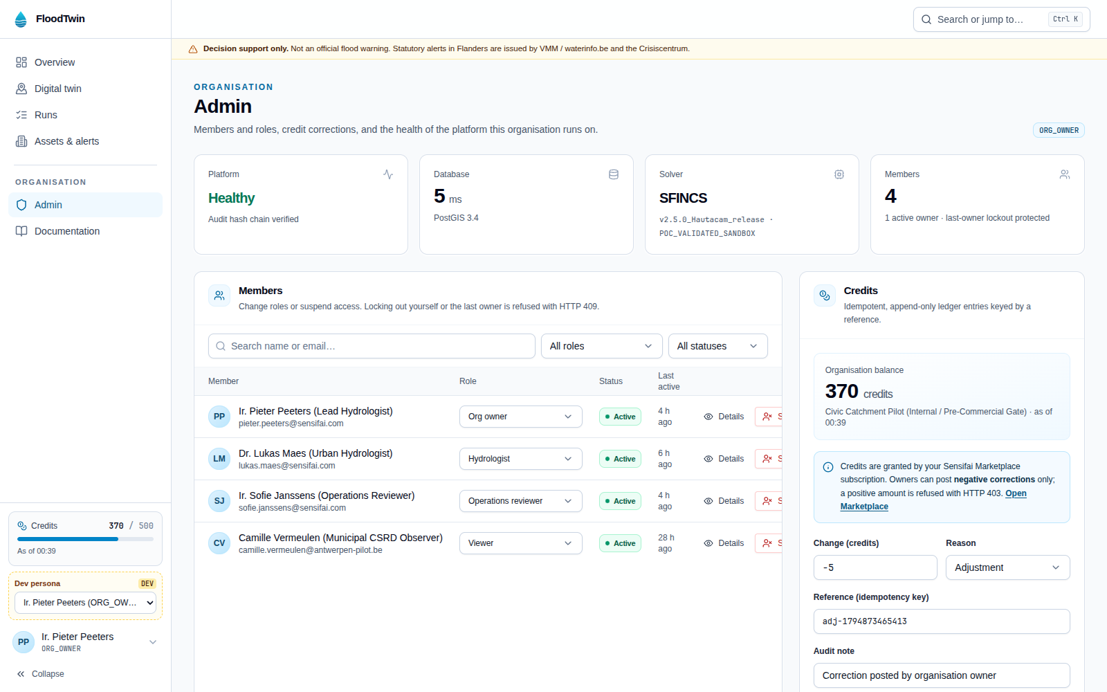
Manage members and credits

Change roles, suspend access and post credit corrections, with safeguards against locking out the last owner.

Admin page with platform health cards, the members table and the credit correction form.
Admin (/admin): platform health, members with confirmation dialogs, and the credit ledger.
  1. 1Open Admin from the sidebar while signed in as an owner.
  2. 2Check platform health: database latency, solver version and audit chain.
  3. 3Search or filter members, change a role or choose Suspend; the dialog names the person before you confirm.
  4. 4Post a negative credit correction with a unique reference. Credits themselves come from your Sensifai Marketplace subscription.

Reference

Credits and guardrails

What costs credits

Prices come from your plan and are shown in the app before you run. A failed run is refunded in full.

  • Inspecting the twin, sampling points, exportsFree
  • Baseline SFINCS runPlan price
  • Mitigation run (Δh)Plan price

Every number carries its basis

OFFICIAL_RECORD
OBSERVED
MODEL_ESTIMATE
INFERENCE
NOT_AVAILABLE
  • 422 SIMULATION_BLOCKED_BY_DATA_READINESS — the area has no verified ≤ 2 m bare-earth LiDAR.
  • 403 BLOCKED_NON_COMMERCIAL_LICENSE — the dataset is licensed CC BY-NC (for example FABDEM).
  • 409 LAST_OWNER_DEMOTION_BLOCKED — the last active owner cannot be removed.
FAQ

Frequently asked questions

Answers are written from the code, the database rules and the pilot measurements.

Try it on the pilot catchment

Open the twin, pick a layer and sample a point. Inspecting is free.

Open the twin